![]()

[Table of Contents] Owenlea Farm
on the Ohio Map
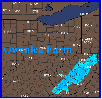
The darker blue area at the top is Lake Erie. The brown area (with no county lines) above the Lake is SouthWestern Ontario, Canada. The light blue area at the lower right is just there to make the map more interesting. It's a snowstorm over West Virginia.
The county with the stair steps on it's top left corner is Medina County, Ohio, the location of Owenlea Holsteins. Immediately south (below) Medina County is Wayne County, the dairy capital of Ohio.
There are about 600 dairy herds in Wayne County with another 600 in the counties that touch Wayne County. Which means that there are 1200 dairy herds within an hour's drive of Owenlea Farm. There is another, slightly smaller, concentration of dairy herds in western Ohio, located just above the "en" in Owenlea.
[Table of Contents] [Top] [fwo@ bright.net]